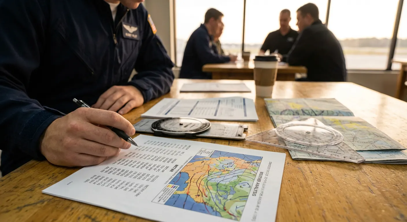
Every flight begins with a decision, and almost every decision begins with the weather. Long before the airplane is preflighted, the fuel is checked, or the runway is selected, the pilot has already made the most consequential call of the day: should this flight happen at all? For a flight student, the preflight briefing — and especially the weather portion of it — is not an academic exercise to satisfy an instructor. It is the foundation skill that will determine whether they become a safe, thinking pilot or a statistic.
The FAA requires it. 14 CFR 91.103 states that "each pilot in command shall, before beginning a flight, become familiar with all available information concerning that flight." For any flight not in the vicinity of an airport, that includes "weather reports and forecasts, fuel requirements, alternatives available if the planned flight cannot be completed, and any known traffic delays." The regulation is short, but it carries the entire weight of preflight planning. Everything else flows from it.
Why the Weather Brief Matters More Than Any Other Preflight Item
The NTSB accident database makes the case more clearly than any instructor could. Year after year, the AOPA Air Safety Institute's Nall Report identifies weather as one of the top causes of fatal general aviation accidents. The pattern is consistent: VFR flight into instrument meteorological conditions, attempted flight in icing, thunderstorm encounters, and gusty crosswind landings produce loss-of-control accidents at a rate that dwarfs nearly every other category.
The shared root cause in the vast majority of these accidents is not bad luck or a sudden change in conditions. It is a flight that should never have departed. Investigators consistently find that the pilot had access to the information that would have prevented the accident, but either did not look at it, did not understand it, or did not apply it to a Go/No-Go decision. The weather brief was either skipped, rushed, or treated as a formality.
For a student pilot, this should be sobering. The single habit that prevents the largest category of fatal GA accidents is one that costs nothing, takes fifteen to thirty minutes, and is fully under the pilot's control. There is no other skill in flight training with that kind of leverage.
What "Briefing Yourself" Actually Means
A preflight briefing is not the act of opening an app and glancing at a colored map. It is a deliberate, structured process of building a complete mental picture of the atmosphere along the entire route — from the surface to the planned cruise altitude, from departure to destination to alternate, and across the full window of time the flight will occupy. A pilot finishes a proper brief able to answer specific questions: What is the weather doing right now? What will it do over the next several hours? What could go wrong? What is my out if it does?
The standard mnemonic taught at every flight school is WKRAFT — Weather, Known ATC delays, Runway lengths, Alternates, Fuel, Takeoff and landing distances. Weather sits at the top of that list intentionally. Every other item depends on it.
The FAA-recognized sources for a legal weather brief are 1800wxbrief.com (the Leidos Flight Service portal), the official aviationweather.gov site operated by the NWS Aviation Weather Center, and approved commercial providers like ForeFlight and Garmin Pilot. These are not interchangeable with consumer weather apps. A legal preflight brief uses aviation-specific products built around aviation-specific decision criteria.
The Anatomy of a Complete Weather Brief
A thorough VFR weather brief covers, at minimum, the following items in order. Each section answers a specific question that affects the Go/No-Go decision.
1. The Big Picture: Surface Analysis and Prog Charts
Before reading a single METAR, a competent pilot looks at the synoptic-scale weather. Where are the fronts? Which way are they moving? Is a high-pressure ridge dominating the route, or is a trough digging in? The Surface Analysis chart and the 12-, 24-, and 36-hour prognostic charts answer this question. They tell you what the atmosphere is going to do, not just what it is doing right now.
A student who skips this step and dives straight into METARs is reading the symptoms without understanding the disease. A 5,000-foot ceiling at the departure airport means very different things if a cold front is approaching from the west versus if the air mass is stable and unchanging.
2. METARs Along the Route
METARs are surface observations issued hourly (or special updates between) at airports with weather reporting. They are the ground truth of what is happening at this moment. A student should pull METARs not just for the departure and destination, but for every reporting station within roughly 20 nautical miles of the planned route, plus the alternate.
The student should be able to read the raw text — not just the decoded version — because raw METARs contain remarks that decoded views often hide. A remark like RMK PRESFR (pressure falling rapidly) or TSB35 (thunderstorm began at :35 past the hour) can change the entire risk picture.
3. TAFs for Departure, Destination, and Alternate
The Terminal Aerodrome Forecast covers the 5-mile radius around the airport for 24 to 30 hours. It is the single most important forecast product for VFR planning. A student must be able to read a TAF in raw form and identify exactly when the forecast changes, what those changes are, and whether any of those windows fall within the planned flight time.
Pay particular attention to TEMPO and PROB groups. A TEMPO -RA BR with visibility 2SM means the forecaster believes those conditions could happen for periods of less than an hour, totaling under half the period. Legally and practically, a TEMPO group can ruin a flight that looks fine on the prevailing forecast.
4. Winds and Temperatures Aloft
Winds aloft (the FB forecast) tell you what the wind will be doing at cruise altitude. For a student doing a 100-mile cross-country, the difference between a 30-knot headwind and a 30-knot tailwind is the difference between making destination with reserves and being on the radio asking for an unfamiliar diversion airport.
Temperature aloft, paired with the freezing level, identifies icing risk. For VFR pilots in non-icing-certified aircraft, the freezing level is essentially a hard ceiling. Visible moisture plus temperatures at or below freezing equals airframe ice. There is no safe amount of structural icing in a typical training aircraft.
5. AIRMETs, SIGMETs, and Convective SIGMETs
These are the FAA's "pay attention now" products. AIRMETs warn of conditions hazardous to light aircraft — IFR conditions, mountain obscuration, turbulence, and icing. SIGMETs warn all aircraft about severe turbulence, severe icing, volcanic ash, and dust storms. Convective SIGMETs flag thunderstorm activity, hail, and strong surface winds.
If your route passes through any active AIRMET or SIGMET area, you must explicitly evaluate whether the named hazard affects the flight. "I noticed there's an AIRMET Sierra for IFR conditions across the entire eastern half of the state, and my route runs right through it" is a legitimate brief item. "I saw the AIRMET but didn't really look at it" is how accidents start.
6. PIREPs
Pilot reports are weather observations from pilots actually flying in the area. They are the only source of real-time information about turbulence, icing, cloud tops, and ride quality at altitude. A METAR can tell you the surface visibility; only a PIREP can tell you what the ride is like at 6,500 feet.
A flight student should learn to file PIREPs as well as read them. Every pilot benefits from the system, and the only way it stays useful is if pilots feed it.
7. NOTAMs and TFRs
Not strictly weather, but always part of a complete brief. Temporary Flight Restrictions can shut down entire corridors with no warning, and unlit obstructions or runway closures discovered during the brief are infinitely better than discovered on short final. A student should review NOTAMs for departure, destination, alternate, and any airport along the route they could realistically divert to.
8. Radar and Satellite Imagery
Radar shows precipitation in real time. Satellite shows cloud structure across the larger picture. Both should be reviewed in animation, not as static snapshots — the trend over the previous few hours tells you more than the current frame. A line of cells that has been moving northeast at 25 knots for three hours will continue to do so. If your route crosses where that line will be in two hours, you have your answer.
What a Good Weather Brief Looks Like in Practice
Below is the format an instructor should be able to expect from any student before a cross-country flight. This is not a template to fill out blindly — it is the kind of structured summary a pilot delivers out loud, on paper, or in a flight log before they ever walk to the airplane.
Sample Cross-Country Weather Brief — KCLT to KCHS
Planned departure: 1400 local. Planned route: KCLT direct KCHS at 6,500 feet. Estimated time enroute: 1+25. Cessna 172, no instrument rating, day VFR.
Synoptic Picture: A weak surface high is centered over Tennessee and drifting east at about 10 knots. No frontal activity within 200 nautical miles of the route. The 24-hour prog chart shows the high remaining dominant through tonight, with a weak trough approaching from the west by tomorrow morning. Stable air mass, light winds, no significant weather expected within the flight window.
Departure (KCLT) — METAR 1753Z: Wind 270 at 8, visibility 10, scattered clouds at 4,500, temperature 24, dewpoint 14, altimeter 30.12. Spread of 10°C — no fog or low ceiling risk for the next several hours.
Destination (KCHS) — METAR 1756Z: Wind 230 at 12 gusting 18, visibility 10, few clouds at 5,000, temperature 26, dewpoint 18, altimeter 30.10. Crosswind component on Runway 21: approximately 2 knots. Manageable, well within personal minimums.
Enroute Stations (KGSP, KCAE): Both reporting VFR with scattered to broken clouds at 5,000–6,000, visibility 10. Consistent with the synoptic picture. No deterioration trend over the last three hourly observations.
TAF KCLT (1718/1824): Through 22Z, wind 270 at 10, visibility 6 in haze, scattered 5,000. From 22Z, wind 250 at 8, visibility 10, scattered 6,000. No TEMPO or PROB groups during the flight window.
TAF KCHS (1718/1824): Through 23Z, wind 230 at 12 gusting 20, visibility 10, scattered 5,000 broken 12,000. TEMPO 1820/1823 wind 240 gusting 25. This is a flag item. A 25-knot gust on Runway 21 produces a crosswind component of around 6 knots — still well within the airplane's demonstrated value and my personal minimum, but I will plan a power-on, slightly faster approach and brief a go-around if the gust factor pushes me beyond stable parameters.
Winds Aloft 6,000 ft (FD): KCLT 2615 +14 (260° at 15 knots, +14°C). Tailwind component approximately 12 knots on the planned course of 165°. ETE 1+25 confirmed against fuel plan with 45-minute reserve.
Freezing Level: 13,000 ft. No icing concern for a 6,500 ft cruise.
AIRMETs / SIGMETs: AIRMET Tango (turbulence) for moderate turb below 12,000 over the western Carolinas, expiring at 21Z — does not affect my route or altitude. No SIGMETs along the route. No Convective SIGMETs anywhere within 200 NM.
PIREPs: Two reports within the last hour from aircraft on similar routes — both reporting smooth ride at 5,000–7,000, scattered cumulus tops 5,500. Consistent with the forecast.
NOTAMs: KCLT runway 18C closed for maintenance 1500–1700 — does not affect my planned 36L departure. KCHS no relevant restrictions. One TFR for a stadium event at KCAE active 2200–0200, well after my arrival.
Radar / Satellite: Clear of precipitation across the entire route. Satellite shows scattered fair-weather cumulus consistent with the surface high. No buildup trend over the last three hours.
Alternate: KMYR (Myrtle Beach) selected. Current METAR shows VFR with similar conditions to KCHS. Fuel for KCLT–KCHS–KMYR plus 45 minutes reserve confirmed.
Personal Minimums Check: All conditions exceed my personal minimums (5 SM visibility, 3,000 ft ceiling, 15 knots wind, 10 knots crosswind, 10-knot gust factor max). The TEMPO at KCHS bears watching — I will request an updated METAR within 30 minutes of arrival and have a divert plan to KMYR if conditions worsen.
Decision: GO. Conditions are well within both regulatory and personal minimums, with one identified watch item (gusty crosswind at destination) that has a clear mitigation and a clear divert option.
What a Bad Brief Looks Like
It is worth seeing the contrast. A poor brief — the kind that precedes most weather-related accidents — sounds like this:
"I checked the weather. It's VFR at the departure and destination. Winds are out of the west. Looks fine. Let's go."
Every word of that brief might be technically true. None of it is sufficient. There is no synoptic picture, no forecast trend, no analysis of the wind aloft, no awareness of AIRMETs, no review of NOTAMs, no alternate, no comparison to personal minimums, no identified watch items, no divert plan. The pilot is launching with a current snapshot and no model of how the day will unfold.
That kind of brief works ninety-nine times. The hundredth time, it kills somebody.
The Habit That Outlives the Checkride
Flight students are tested on weather briefing during the private pilot checkride. Many treat it as something to perform once for the examiner and then quietly drop in favor of a quick app glance. That is exactly the wrong lesson. A checkride brief is the bare minimum performance standard, not the high-water mark.
The pilots who fly for decades without a weather-related accident share a common trait: they brief every flight, even short local ones, with deliberate structure. They look at the synoptic picture before the METAR. They read the raw TAF. They check PIREPs and file them. They identify watch items and write down divert plans. They compare conditions to personal minimums explicitly, in words, before they walk to the airplane. They do this whether the flight is one hour or six.
This habit cannot be installed by an instructor in the last week of training. It is built across the entire course of flight school, by an instructor who refuses to accept thin briefs, asks specific questions, and demands the student do the work of reading raw products and explaining them out loud. A flight school that treats the weather brief as a serious professional discipline produces pilots who keep flying. A flight school that treats it as a formality produces pilots who, sooner or later, find out the hard way why it isn't.
For Instructors: Make the Brief a Conversation, Not a Checklist
The most effective way to teach weather briefing is not to assign a worksheet. It is to sit across from the student before each flight and ask probing questions: What is the surface high doing? Which TEMPO group worries you and why? If the destination dropped to MVFR while you were enroute, what is your plan? Show me the PIREP that supports your altitude choice. Where is the freezing level and why does it matter today?
A student who can answer those questions comfortably is on the way to becoming a pilot. A student who can only point at green dots on a moving map is not yet ready to be alone in an airplane, regardless of stick-and-rudder skill.
The investment of fifteen extra minutes before each flight, asking these questions, may be the single most valuable thing an instructor does in a student's training. It builds the discipline that will, years later, when the student is a certificated pilot far from any instructor, be the only thing standing between them and a bad decision.
Flight Suite HQ includes integrated weather briefing tools, route weather summaries, and a Personal Weather Minimums feature that compares current conditions to a pilot's pre-set limits before every checkout. Students and instructors can use these together to build the kind of structured, repeatable preflight discipline that produces safe pilots.